
Features Flood Zone Map
This app displays a printable map that shows the flood-prone areas near a given street address in the United States.
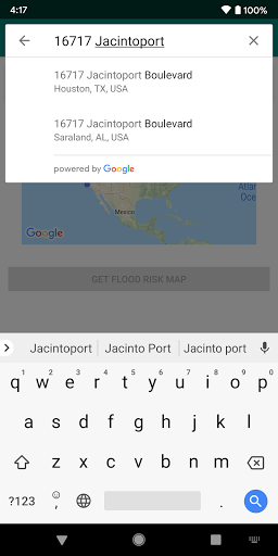
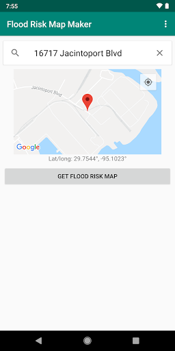
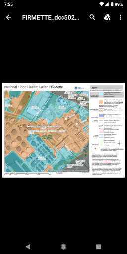
Identify flood zones to watch out for after a rainstorm, tropical storm, or hurricane.To use:• Type your street address in the "Address" field• Tap the "Get Flood Risk Map" buttonMaps generated by this app are not interactive maps, but maps—usually PDFs—that are suitable for emailing and printing out on paper.Depending on the availability of the flood study data in your area, this app will generate one of the following results:• Areas with modern digital FEMA flood study data: A printable PDF showing about 400 acres or about 0.6 sq.
mi.• Areas with old FEMA flood study data: A zip file with a scanned image of an old (often 1980s) printed map• Remote areas where a FEMA flood study has not been conducted: No map availableIdeal for:
★ Homeowners and home buyers
★ Real estate agents
★ Farmers
★ Insurance professionals
★ Businesspeople
★ Anyone doing a risk assessment or asking "Am I in a flood zone?"Ad-supported.
If you like the app, please consider upgrading to remove the ads and support future development.HAVING TROUBLE?This app requires having a PDF viewer app—such as the Adobe Acrobat Reader app—installed on your phone.
Many phones have one installed already.
You also need to have a web browser app installed, like Google Chrome or Firefox.If the FEMA study data in your location is old, youll need to have an app for opening zip files (such as Winzip) and an app for opening TIFF files (such as Multi-TIFF Viewer Free) so you can open the scanned maps that are used for those locations.Hurricane Irma aftermath photo by Wade Austin Ellis
Gaming Features
Enjoy immersive gaming experience with various game modes.
Camera Features
Advanced camera features with editing capabilities.
Learning Tools
Enhance your learning experience with interactive features.
See the Flood Zone Map in Action
Get the App Today
Available for Android 8.0 and above